
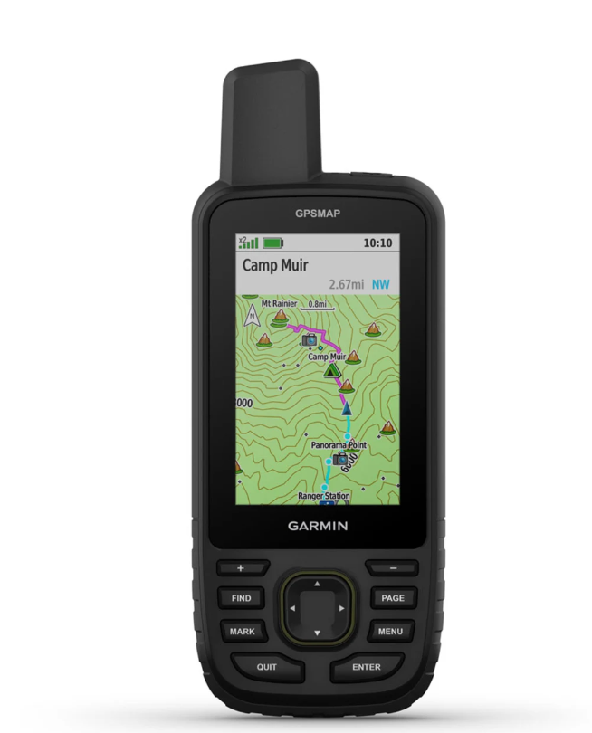
GARMIN GPSMAP 67 GPS Handheld
Lens Material: chemically strengthened glass
Dimension: 2.5” x 6.4” x 1.4” (6.2 x 16.3 x 3.5 cm)
Weight: 8.1 oz (230 g) with batteries
Water rating: IPX7
MIL-STD-810: yes (thermal, shock, water)
Display Type: transflective color TFT
Display Size: 1.5"W x 2.5"H (3.8 x 6.3 cm); 3" diag (7.6 cm)
Display resolution: 240 x 400 pixels
Battery type: rechargeable, internal lithium-ion
Battery life:
Up to 180 hours in default mode
Up to 840 hours in expedition mode
Memory/History: 16 GB (user space varies based on included mapping)
Interface: USB-C
Maps & Memory
Preloaded maps: yes (TopoActive, routable)
Ability to add maps
Basemap
Automatic routing (turn by turn routing on roads) for outdoor activities
Map segments: 15000
Satellite Imagery: yes (direct to device)
Includes detailed hydrographic features (coastlines, lake/river shorelines, wetlands and perennial and seasonal streams)
Includes searchable points of interests (parks, campgrounds, scenic lookouts and picnic sites)
External memory storage: yes (32 GB max microSD™ card, not included)
Waypoints/favorites/locations: 10000
Courses: 250, 200 course points per course
Tracks: 250
Navigation Track Log: 20,000 points, 250 saved gpx tracks, 300 saved fit
Activities
Navigation Routes: 250, 250 points per route; 50 points auto routing
Rinex logging
Sensors
GPS
GLONASS
Galileo
QZSS
BeiDou
IRNSS
Barometric altimeter
Compass: Yes (tilt-compensated 3-axis)
High-sensitivity receiver
GPS compass (while moving)
Multi-band frequency support
Daily Smart Features
Connect IQ™ (downloadable watch faces, data fields, widgets and apps)
Smart notifications on handheld
Weather forecasts
Active Weather
VIRB® Remote
Pairs with Garmin Connect™ Mobile
Safety and Tracking Features
LiveTrack
Tactical Features
XERO™ Locations
Ballistics solver: yes (unlock required)
Outdoor Recreation
Point-to-point navigation
Area calculation
Fish forecast
Sun and moon information
Geocaching-friendlyyes (Geocache Live)
Custom maps compatibleyes (500 custom map tiles)
Picture viewer
LED beacon flashlight
inReach® Features
inReach remote compatible
Outdoor Applications
Compatible with Garmin Explore™ app
Garmin Explore website compatible
Connections
Connections Wireless Connectivity: yes (Wi-Fi®, BLUETOOTH®, ANT+®)
Get exclusive volume discounts, bulk pricing updates, and new product alerts delivered directly to your inbox.
By subscribing, you agree to our Terms of Service and Privacy Policy.
Direct access to our certified experts